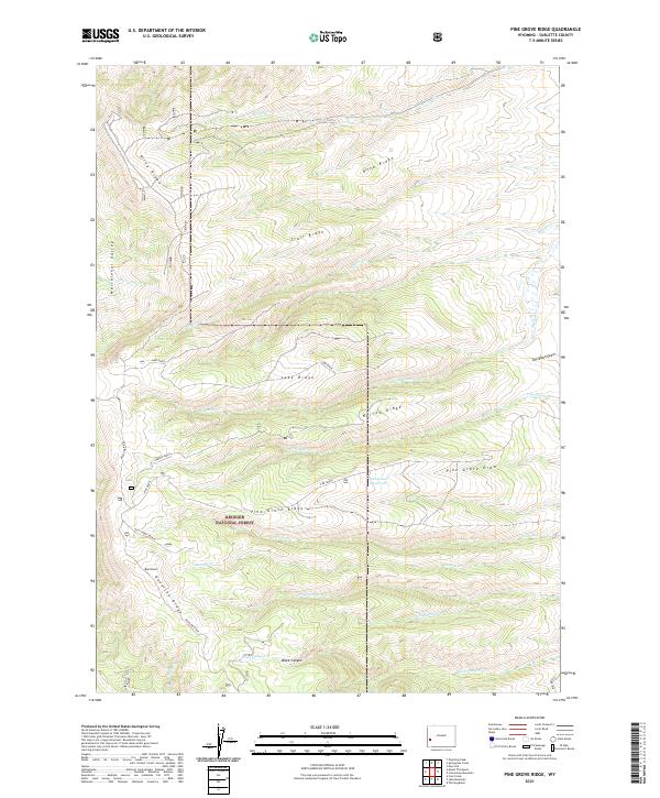
2021 Map of Pine Grove Ridge
USGS Topo · Published 2021About this map
Bridger National Forest land dominates this high-elevation landscape in Sublette County, defined by a series of prominent parallel ridges and deep drainage draws. The central elevation is anchored by Pine Grove Ridge, which gives way to the seasonal waters of the Pine Grove Reservoir and the headwaters of numerous creeks including Pine Grove Cr and Sawmill Cr. The complex topography features several distinct geological formations, from the sharp ascent of Deadline Ridge and Riley Ridge to the broad expanse of Meridional Valley in the northwest corner.
Find a feature on this map
30 named features on this map. Tap any name to fly to it.
Don’t see what you’re looking for? This feature index may not catch every label — zoom into the map to look around manually.
Map Details
Editions of this 2021 Pine Grove Ridge Map
This is the sole edition of this map. No revisions or reprints were ever made.
Other maps of this area

1921 · Afton
USGS Topo · 1:125,000

1936 · Cokeville
USGS Topo · 1:96,000

1939 · Big Piney
USGS Topo · 1:125,000

1942 · Cokeville
USGS Topo · 1:125,000

1942 · Big Piney
USGS Topo · 1:125,000

1955 · Preston
USGS Topo · 1:250,000

1958 · Preston
USGS Topo · 1:250,000

1962 · Preston
USGS Topo · 1:250,000
1967 · Coal Creek
USGS Topo · 1:24,000

1967 · Mount Thompson
USGS Topo · 1:24,000