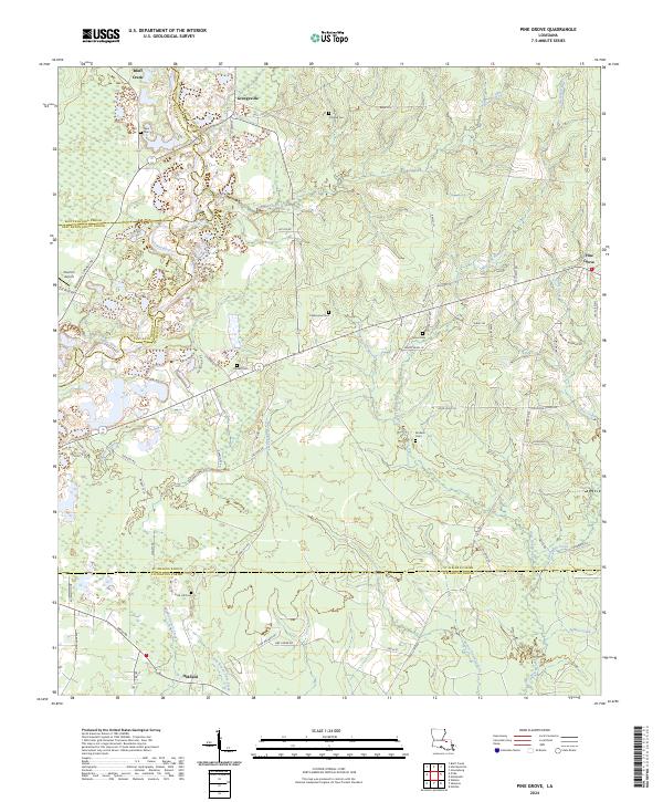
2024 Map of Pine Grove
USGS Topo · Published 2024About this map
Grangeville and Pine Grove anchor this 2024 landscape in St. Helena Parish, where the Amite River carves a winding path through the western timberlands and wetlands. The geography of the area is defined by its deep genealogical roots, visible through a high density of family and community burial grounds such as Naul Cem, Thomas Cem, and Sand Hill Cem. The road network, including State Rte 449 and Greenwell Springs Rd, connects small settlements across several parish lines, with the map recording the meeting point of St. Helena, East Feliciana, East Baton Rouge, and Livingston. Waterways like Pigeon Creek and Beaver Dam Creek drain the low-lying terrain, creating a complex hydrographic system that has likely influenced local property boundaries and rural development for generations. This survey provides a contemporary view of the intersection between historic family estates and the natural drainage basins of the Florida Parishes.
Find a feature on this map
78 named features on this map. Tap any name to fly to it.
Don’t see what you’re looking for? This feature index may not catch every label — zoom into the map to look around manually.
Map Details
Editions of this 2024 Pine Grove Map
This is the sole edition of this map. No revisions or reprints were ever made.
Other maps of this area

1941 · Gilead
USGS Topo · 1:31,680

1942 · Montpelier
USGS Topo · 1:31,680

1942 · Pine Grove
USGS Topo · 1:31,680

1942 · Pride
USGS Topo · 1:31,680

1942 · Gilead
USGS Topo · 1:31,680

1942 · Watson
USGS Topo · 1:31,680

1942 · Satsuma
USGS Topo · 1:31,680

1949 · Bluff Creek
USGS Topo · 1:31,680

1950 · Doyle
USGS Topo · 1:31,680

1950 · Greensburg
USGS Topo · 1:31,680