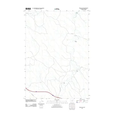
2012 Map of Pine Gulch
USGS Topo · Published 2012About this map
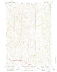
Crazy Woman Cr winds through this section of Johnson County, creating a deeply etched drainage system defined by named features like McCray Draw, Meadow Draw, and Grub Draw. The landscape is a mix of high-plains ranching and significant infrastructure, anchored by the Jack Payne Ranch in the north and the interstate corridor crossing the southern portion of the quadrangle. The namesake Pine Gulch sits just west of the creek's lower reaches, while the Heather Reservoir provides a critical water source in the southeastern corner. This modern survey illustrates the persistent ranching footprint in the region, where access is provided by a network of local routes such as Tipperary Rd, Luddeck Rd, and Lower Crazy Woman Rd, tracing the same paths utilized by generations of Wyoming stockmen.
Find a feature on this map
14 named features on this map. Tap any name to fly to it.
Don’t see what you’re looking for? This feature index may not catch every label — zoom into the map to look around manually.
Map Details
Editions of this 2012 Pine Gulch Map
This is the sole edition of this map. No revisions or reprints were ever made.
Other maps of this area

1900 · Fort McKinney
USGS Topo · 1:125,000

1903 · Fort McKinney
USGS Topo · 1:125,000

1955 · Sheridan
USGS Topo · 1:250,000

1958 · Sheridan
USGS Topo · 1:250,000

1962 · Sheridan
USGS Topo · 1:250,000

1970 · Buffalo NE
USGS Topo · 1:24,000
1970 · Buffalo SE
USGS Topo · 1:24,000
1972 · Crazy Woman Ranch
USGS Topo · 1:24,000
1972 · Ploessers Draw
USGS Topo · 1:24,000
1972 · Pine Gulch
USGS Topo · 1:24,000