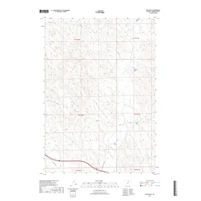
2017 Map of Pine Gulch
USGS Topo · Published 2017About this map
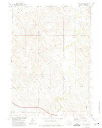
Crazy Woman Cr winds through this Johnson County landscape, carving a complex network of drainages that define the local topography. This 2017 study illustrates the drainage patterns of the high plains, where named features like Pine Gulch and Meadow Draw meet the larger creek system. The map reveals a land divided by ranching and access roads, including Town Rd and Tipperary Rd, which serve the dispersed rural properties. Human influence on the arid environment is most visible at Heather Reservoir in the southeast corner. The presence of Luddeck Rd and T W Rd indicates a reliance on a well-established grid of local connectors for moving livestock and supplies across the varied terrain of the Powder River Basin region.
Find a feature on this map
19 named features on this map. Tap any name to fly to it.
Don’t see what you’re looking for? This feature index may not catch every label — zoom into the map to look around manually.
Map Details
Editions of this 2017 Pine Gulch Map
This is the sole edition of this map. No revisions or reprints were ever made.
Other maps of this area

1900 · Fort McKinney
USGS Topo · 1:125,000

1903 · Fort McKinney
USGS Topo · 1:125,000

1955 · Sheridan
USGS Topo · 1:250,000

1958 · Sheridan
USGS Topo · 1:250,000

1962 · Sheridan
USGS Topo · 1:250,000

1970 · Buffalo NE
USGS Topo · 1:24,000
1970 · Buffalo SE
USGS Topo · 1:24,000
1972 · Crazy Woman Ranch
USGS Topo · 1:24,000
1972 · Ploessers Draw
USGS Topo · 1:24,000
1972 · Pine Gulch
USGS Topo · 1:24,000