
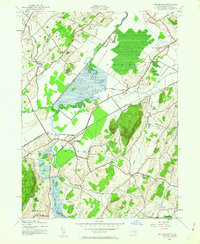
1942 Map of Pine Island
USGS Topo · Published 1954About this map
The Wallkill River and its intricate network of drainage canals define the agricultural landscape of this Orange County borderland during the early 1940s. The Cheechunk Canal cuts a straight path through the lowlands, managing the waters of the Pumpkin Swamp and Quaker Creek to support the local farming economy. Settlement is concentrated in small hamlets and junction points such as Pine Island, where the Lehigh and New England railroad intersects with local roads.
Find a feature on this map
35 named features on this map. Tap any name to fly to it.
Don’t see what you’re looking for? This feature index may not catch every label — zoom into the map to look around manually.
Map Details
Editions of this 1942 Pine Island Map
2 editions found
Other maps of this area

1888 · Franklin
USGS Topo · 1:62,500

1891 · Greenwood Lake
USGS Topo · 1:62,500

1893 · Greenwood Lake
USGS Topo · 1:62,500

1894 · Franklin
USGS Topo · 1:62,500

1897 · Franklin
USGS Topo · 1:62,500

1903 · Franklin Furnace
USGS Topo · 1:62,500

1903 · Greenwood Lake
USGS Topo · 1:62,500

1906 · Port Jervis
USGS Topo · 1:62,500

1906 · Goshen
USGS Topo · 1:62,500

1908 · Goshen
USGS Topo · 1:62,500