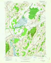
1942 Map of Pine Island
USGS Topo · Published 1963About this map
The Wallkill River and its intricate drainage network, including the Cheechunk Canal, define this agricultural and wetland region during the early 1940s. The landscape is a patchwork of fertile lowlands and sudden rises, punctuated by the twin peaks of Mt Adam and Mt Eve. This area is marked by a high density of small rural hamlets that served as focal points for the local farming community, such as Pine Island, Snufftown, and Little York.
Find a feature on this map
38 named features on this map. Tap any name to fly to it.
Don’t see what you’re looking for? This feature index may not catch every label — zoom into the map to look around manually.
Map Details
Editions of this 1942 Pine Island Map
2 editions found

Other maps of this area

1888 · Franklin
USGS Topo · 1:62,500

1891 · Greenwood Lake
USGS Topo · 1:62,500

1893 · Greenwood Lake
USGS Topo · 1:62,500

1894 · Franklin
USGS Topo · 1:62,500

1897 · Franklin
USGS Topo · 1:62,500

1903 · Franklin Furnace
USGS Topo · 1:62,500

1903 · Greenwood Lake
USGS Topo · 1:62,500

1906 · Port Jervis
USGS Topo · 1:62,500

1906 · Goshen
USGS Topo · 1:62,500

1908 · Goshen
USGS Topo · 1:62,500