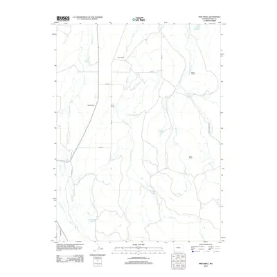
2012 Map of Pine Knoll
USGS Topo · Published 2012About this map
Hilliard Flat and the surrounding high plains of Uinta County are defined by an extensive network of water management features and seasonal drainages. The landscape is dotted with small-scale irrigation and livestock infrastructure, including Massae Reservoir, Martin Reservoir, and Austin Reservoir. These water sources are vital in this arid region, fed by a series of creeks such as Sulphur Cr and Willow Cr that cut through the terrain. Evidence of the area's agricultural and pastoral history is visible in the presence of the Blacks Fork Sheep Trl, which suggests long-standing livestock movement across the high desert. Prominent landforms like Pine Knoll and Rocky Point provide navigational landmarks in a territory otherwise marked by wide draws like Short Draw and Cook Draw.
Find a feature on this map
25 named features on this map. Tap any name to fly to it.
Don’t see what you’re looking for? This feature index may not catch every label — zoom into the map to look around manually.
Map Details
Editions of this 2012 Pine Knoll Map
This is the sole edition of this map. No revisions or reprints were ever made.
Other maps of this area

1885 · Uinta
USGS Topo · 1:250,000

1901 · Hayden Peak
USGS Topo · 1:125,000

1903 · Hayden Peak
USGS Topo · 1:125,000

1954 · Salt Lake City
USGS Topo · 1:250,000

1954 · Ogden
USGS Topo · 1:250,000

1958 · Ogden
USGS Topo · 1:250,000

1958 · Salt Lake City
USGS Topo · 1:250,000

1960 · Ogden
USGS Topo · 1:250,000

1960 · Salt Lake City
USGS Topo · 1:250,000

1965 · Myers Reservoir
USGS Topo · 1:24,000