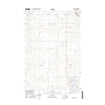
2015 Map of Pine Lake
USGS Topo · Published 2015About this map
Pine Lake and the surrounding woodlands of Iron County define this landscape near the Michigan border. The terrain is characterized by a dense network of water bodies and drainage systems, including the W Fork Montreal River and Gile Flowage. Significant islands like Anchor Island and Paradise Island sit within Pine Lake, providing distinct geographic markers for the area. The map reveals a grid of rural roads, many bearing family or local names such as Abelson Rd, Kuusisto Rd, and Mutanen Rd, suggesting a history of local settlement and land use. Small lakes like Obadash Lake, Lake One, and Little Pine Lake are scattered across the quadrangle, connected by a web of creeks including Laymans Cr and Lake One Cr. This survey illustrates the intricate relationship between the hydrologic features and the developing transportation network in the north woods during the early 21st century.
Find a feature on this map
51 named features on this map. Tap any name to fly to it.
Don’t see what you’re looking for? This feature index may not catch every label — zoom into the map to look around manually.
Map Details
Editions of this 2015 Pine Lake Map
This is the sole edition of this map. No revisions or reprints were ever made.
Other maps of this area

1940 · Mercer
USGS Topo · 1:48,000

1940 · Butternut
USGS Topo · 1:48,000

1940 · Upson
USGS Topo · 1:48,000

1943 · Upson
USGS Topo · 1:48,000

1943 · Ironwood
USGS Topo · 1:48,000

1945 · Mercer
USGS Topo · 1:48,000

1947 · Butternut
USGS Topo · 1:48,000

1947 · Mercer
USGS Topo · 1:48,000

1950 · Butternut
USGS Topo · 1:48,000

1953 · Ashland
USGS Topo · 1:250,000