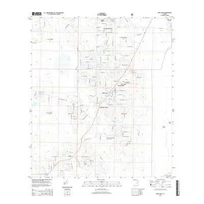
2015 Map of Pine Lakes
USGS Topo · Published 2015About this map
Cassia and its surrounding lake-dotted landscape are the focal point of this modern survey of eastern Lake County. The settlement pattern is defined by clusters of residential developments and rural outposts like Lake Mack Park, Florida Hills, and Pine Lakes, which are interspersed between dozens of distinct water bodies. Significant hydrologic features such as Tracy Canal and Black Water Cr indicate the intricate drainage network of this low-lying region. Local genealogy interest is centered on the Cassia Cem, while small-scale aviation is represented by Bradshaw Farm Airport and the Britt Brown & Porter Ranch Airport. The map also details the southern portions of the Ocala National Forest area, including landmarks like Otter Mound and Bush Island, alongside the path of SR-44 as it cuts through the pine-covered terrain.
Find a feature on this map
149 named features on this map. Tap any name to fly to it.
Don’t see what you’re looking for? This feature index may not catch every label — zoom into the map to look around manually.
Map Details
Editions of this 2015 Pine Lakes Map
This is the sole edition of this map. No revisions or reprints were ever made.
Other maps of this area

1954 · Daytona Beach
USGS Topo · 1:250,000

1955 · Orlando
USGS Topo · 1:250,000

1957 · Orlando
USGS Topo · 1:250,000

1958 · Orlando
USGS Topo · 1:250,000

1958 · Daytona Beach
USGS Topo · 1:250,000

1960 · Sorrento
USGS Topo · 1:24,000

1962 · Orlando
USGS Topo · 1:250,000

1962 · Pine Lakes
USGS Topo · 1:24,000

1962 · Lake Woodruff
USGS Topo · 1:24,000

1964 · Daytona Beach
USGS Topo · 1:250,000