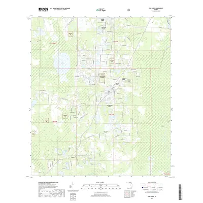
2018 Map of Pine Lakes
USGS Topo · Published 2018About this map
Ocala National Forest dominates much of this landscape, where the northern reaches of Lake County meet a dense network of water bodies and small rural enclaves. The settlement of Cassia and its nearby Cassia Cem provide a focal point for genealogical research in the southern portion of the sheet. The terrain is defined by a high concentration of lakes including Lake Mack, Saint Claire Lake, and Lake Marion, illustrating the area's complex hydrology. Aviation and agricultural history are represented by local facilities like the Bradshaw Tree Farm Airport and Rose Ranch Airport. Residential growth is evident in pockets such as Forest Hills and Florida Hills, which are connected by a grid of local roads named for trees and fruits, such as Chinaberry St and Apricot Ave.
Find a feature on this map
153 named features on this map. Tap any name to fly to it.
Don’t see what you’re looking for? This feature index may not catch every label — zoom into the map to look around manually.
Map Details
Editions of this 2018 Pine Lakes Map
This is the sole edition of this map. No revisions or reprints were ever made.
Other maps of this area

1954 · Daytona Beach
USGS Topo · 1:250,000

1955 · Orlando
USGS Topo · 1:250,000

1957 · Orlando
USGS Topo · 1:250,000

1958 · Orlando
USGS Topo · 1:250,000

1958 · Daytona Beach
USGS Topo · 1:250,000

1960 · Sorrento
USGS Topo · 1:24,000

1962 · Orlando
USGS Topo · 1:250,000

1962 · Pine Lakes
USGS Topo · 1:24,000

1962 · Lake Woodruff
USGS Topo · 1:24,000

1964 · Daytona Beach
USGS Topo · 1:250,000