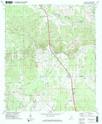
1971 Map of Pine Level
USGS Topo · Published 1974About this map
Pine Level serves as a central hub in southeast Montgomery County, where the landscape is defined by a dense network of creek drainages including Sandy Creek, Olustee Creek, and Greenbrier Creek. The early 1970s terrain reveals a community anchored by rural institutions, such as Warrior Hill Ch and Bethesda Ch, alongside specialized landmarks like the Frazer-McLeod Dam and Sellers Ponds. Historical transportation routes like Old Pike Road and Woodley Road trace the ridges, while the Meriwether Trail cuts across the southern portion of the quadrangle. Genealogists may find value in the location of the Possum Trot Cem and the small settlement of Macedonia near the Patraliga Creek headwaters. This survey documents the area just before significant modern highway expansion, preserving the rural character of family-named hills like Warrior Hill and local gathering spots like Lake Ben.
Find a feature on this map
31 named features on this map. Tap any name to fly to it.
Don’t see what you’re looking for? This feature index may not catch every label — zoom into the map to look around manually.
Map Details
Editions of this 1971 Pine Level Map
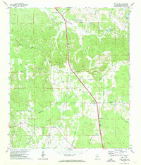
2 editions found
Other maps of this area

1953 · Montgomery
USGS Topo · 1:250,000

1953 · Andalusia
USGS Topo · 1:250,000

1953 · Dothan
USGS Topo · 1:250,000

1954 · Dothan
USGS Topo · 1:250,000

1955 · Dothan
USGS Topo · 1:250,000

1955 · Phenix City
USGS Topo · 1:250,000

1956 · Montgomery
USGS Topo · 1:250,000

1957 · Phenix City
USGS Topo · 1:250,000

1957 · Montgomery
USGS Topo · 1:250,000

1957 · Andalusia
USGS Topo · 1:250,000