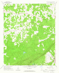
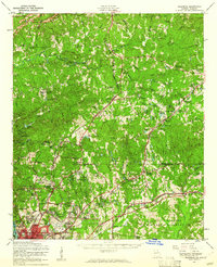
1964 Map of Pine Mountain SW
USGS Topo · Published 1966About this map
Hamilton and the small rural hub of Smiths Crossroads anchor this mid-1960s survey of the Georgia Piedmont, where the Central of Georgia railroad tracks cut through the eastern landscape. The area is defined by the prominent ridges of Pine Mountain and Oak Mountain, with numerous small family-named cemeteries such as Old Hopewell Cem and Hadley Cem scattered across the wooded slopes. This period of local development is marked by the presence of Carver High Sch and the Sunnyside Community Club, serving as vital centers for the surrounding rural population.
Find a feature on this map
36 named features on this map. Tap any name to fly to it.
Don’t see what you’re looking for? This feature index may not catch every label — zoom into the map to look around manually.
Map Details
Editions of this 1964 Pine Mountain SW Map
2 editions found
Other maps of this area

1907 · Talbotton
USGS Topo · 1:125,000

1907 · Opelika
USGS Topo · 1:125,000

1909 · Opelika
USGS Topo · 1:125,000

1950 · Mulberry Grove
USGS Topo · 1:24,000

1950 · Cataula
USGS Topo · 1:24,000

1950 · Ellerslie
USGS Topo · 1:62,500
1955 · Mulberry Grove
USGS Topo · 1:24,000
1955 · Cataula
USGS Topo · 1:24,000
1955 · Ellerslie
USGS Topo · 1:62,500

1955 · Phenix City
USGS Topo · 1:250,000