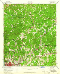
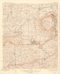
1955 Map of Ellerslie
USGS Topo · Published 1961About this map
Mulberry Creek winds through the northern reaches of Harris County, defining a landscape of small agricultural settlements and dozens of private impoundments. In the mid-1950s, the region was characterized by its transitioning rural economy, visible in features like the Hudson Mill Rapids and the scattering of community landmarks such as the Good Samaritan Home for Aged near Waverly Hall. The map reveals the expansion of Columbus northward into Muscogee County, where suburban developments like Highland Pines and Lincoln Hills began to appear alongside long-standing institutions like the Muscogee County Work Camp. Transportation is anchored by the Central of Georgia and Southern railroads, which connect established towns like Cataula and Ellerslie to the growing industrial center. The southeastern corner is dominated by the sprawling northern boundary of the Fort Benning Military Reservation, providing a sharp contrast to the surrounding residential and farming tracts.
Find a feature on this map
101 named features on this map. Tap any name to fly to it.
Don’t see what you’re looking for? This feature index may not catch every label — zoom into the map to look around manually.
Map Details
Editions of this 1955 Ellerslie Map
This is the sole edition of this map. No revisions or reprints were ever made.
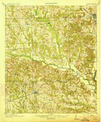
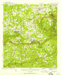
Other maps of this area

1907 · Talbotton
USGS Topo · 1:125,000

1907 · Opelika
USGS Topo · 1:125,000
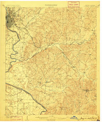
1908 · Columbus
USGS Topo · 1:62,500

1909 · Opelika
USGS Topo · 1:125,000
1914 · Seale
USGS Topo · 1:62,500

1929 · Columbus
USGS Topo · 1:48,000
1934 · Warm Springs
USGS Topo · 1:62,500
1936 · Warm Springs
USGS Topo · 1:62,500

1947 · Columbus
USGS Topo · 1:62,500
1949 · Midland
USGS Topo · 1:24,000