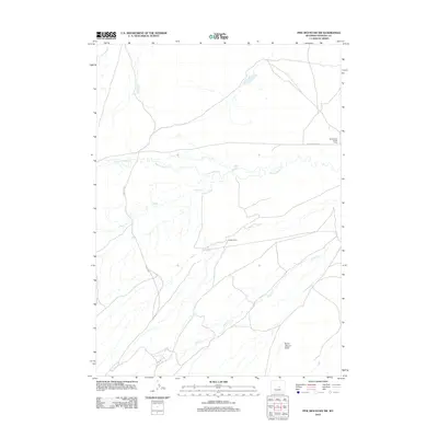
2012 Map of Pine Mountain SW
USGS Topo · Published 2012About this map
Dodds Ranch and West Poison Spider Camp anchor this high-plains landscape in western Natrona County, where land use is defined by ranching and petroleum interests. The drainage network is particularly detailed, tracing the winding courses of Poison Spider Cr and its tributaries, including Soap Cr and Austin Cr. The presence of Forest Oil Rd indicates the industrial footprint of the region's energy sector during the early 21st century. Further south, the evocative name Burnt Wagon Draw hints at the area's overland travel history, while S Fork Casper Cr marks the northern extent of this arid terrain. This topographic survey captures the sparse settlement patterns typical of the Wyoming interior, where life revolves around the intersection of water sources and resource extraction routes.
Find a feature on this map
9 named features on this map. Tap any name to fly to it.
Don’t see what you’re looking for? This feature index may not catch every label — zoom into the map to look around manually.
Map Details
Editions of this 2012 Pine Mountain SW Map
This is the sole edition of this map. No revisions or reprints were ever made.
Other maps of this area

1951 · Pine Mountain SW
USGS Topo · 1:24,000

1951 · Poison Spider
USGS Topo · 1:24,000

1951 · Benton Basin NE
USGS Topo · 1:24,000

1951 · Mc Cleary Reservoir
USGS Topo · 1:24,000

1951 · Square Top Butte
USGS Topo · 1:24,000

1951 · Reid Canyon
USGS Topo · 1:24,000

1955 · Casper
USGS Topo · 1:250,000

1958 · Casper
USGS Topo · 1:250,000

1959 · Gaylord Reservoir
USGS Topo · 1:24,000

1959 · Eightmile Draw
USGS Topo · 1:24,000