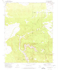
1972 Map of Pine Park
USGS Topo · Published 1975About this map
Beaver Dam State Park and the Dixie National Forest meet at the rugged intersection of the Nevada and Utah borders in this early 1970s survey. The landscape is defined by the headwaters of numerous drainages including Barn Wash and Headwaters Pine Park Canyon, where dramatic terrain features like Split Canyon and White Rocks punctuate the high country. The Union Pacific line cuts through the northwestern corner, serving as a vital transportation corridor while smaller Jeep Trails provide access to interior landmarks.
Find a feature on this map
42 named features on this map. Tap any name to fly to it.
Don’t see what you’re looking for? This feature index may not catch every label — zoom into the map to look around manually.
Map Details
Editions of this 1972 Pine Park Map
2 editions found
Other maps of this area

1885 · St. George
USGS Topo · 1:250,000

1885 · Pioche
USGS Topo · 1:250,000

1886 · Pioche
USGS Topo · 1:250,000

1891 · St. George
USGS Topo · 1:250,000

1953 · Cedar City
USGS Topo · 1:250,000

1954 · Caliente
USGS Topo · 1:250,000

1958 · Cedar City
USGS Topo · 1:250,000

1958 · Docs Pass
USGS Topo · 1:24,000

1959 · Caliente
USGS Topo · 1:250,000

1962 · Cedar City
USGS Topo · 1:250,000