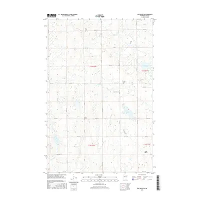
2016 Map of Pine River SW
USGS Topo · Published 2016About this map
Lake Shore anchors the southeast corner of this northern Minnesota landscape, where the terrain is defined by a dense network of glacial water bodies and wetlands. The drainage patterns of Mayo Cr, Stony Brook, and Home Brook cut through the timbered sections, connecting larger waters like Upper Loon Lake and Goose Lake. For genealogists and local historians, the sheet is particularly valuable for its documentation of rural burial grounds, including Mayo Creek Cem, Lunde Cem, Grace Lutheran Cem, and Pleasant Hill Cem. The road network, including Co HWY 1 and Co HWY 17, provides a clear view of how modern rural infrastructure follows the section lines of the Public Land Survey System, specifically within Townships 135 and 136 North. This 2016 survey reflects the contemporary layout of these Cass County communities, preserving the location of family-named landmarks and quiet country roads.
Find a feature on this map
39 named features on this map. Tap any name to fly to it.
Don’t see what you’re looking for? This feature index may not catch every label — zoom into the map to look around manually.
Map Details
Editions of this 2016 Pine River SW Map
This is the sole edition of this map. No revisions or reprints were ever made.
Other maps of this area

1916 · Pillager
USGS Topo · 1:62,500

1919 · Pillager
USGS Topo · 1:62,500

1919 · Leader
USGS Topo · 1:62,500

1953 · Brainerd
USGS Topo · 1:250,000

1957 · Brainerd
USGS Topo · 1:250,000

1958 · Brainerd
USGS Topo · 1:250,000

1959 · Nisswa
USGS Topo · 1:24,000

1959 · Pine River
USGS Topo · 1:24,000

1959 · Jenkins
USGS Topo · 1:24,000

1959 · Pine River SW
USGS Topo · 1:24,000