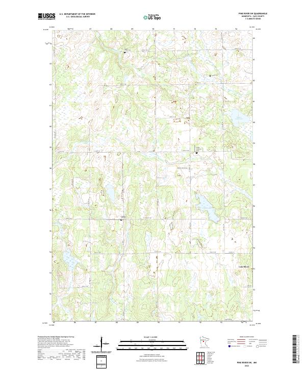
2022 Map of Pine River SW
USGS Topo · Published 2022About this map
Lake Shore anchors the southeast corner of this landscape in Cass County, where the transition from woodland to wetland is defined by a dense network of glacial water bodies. The terrain is characterized by intricate drainage patterns, with Stony Brook, Home Brook, and Cory Brook meandering through low-lying areas. This contemporary survey by the U.S. Geological Survey preserves the locations of several community landmarks essential for genealogical research, including Grace Lutheran Cem, Pleasant Hill Cem, Mayo Creek Cem, and Lunde Cem. These sites, alongside larger water features like Goose Lake and Upper Loon Lake, provide stable reference points in an area largely dominated by the Public Land Survey System grids of t136n r30w and t135n r29w. The map details the local road network, from established routes like Co Hwy 1 to rural reaches such as Brook View Ln SW.
Find a feature on this map
30 named features on this map. Tap any name to fly to it.
Don’t see what you’re looking for? This feature index may not catch every label — zoom into the map to look around manually.
Map Details
Editions of this 2022 Pine River SW Map
This is the sole edition of this map. No revisions or reprints were ever made.
Other maps of this area

1916 · Pillager
USGS Topo · 1:62,500

1919 · Pillager
USGS Topo · 1:62,500

1919 · Leader
USGS Topo · 1:62,500

1953 · Brainerd
USGS Topo · 1:250,000

1957 · Brainerd
USGS Topo · 1:250,000

1958 · Brainerd
USGS Topo · 1:250,000

1959 · Nisswa
USGS Topo · 1:24,000

1959 · Pine River
USGS Topo · 1:24,000

1959 · Jenkins
USGS Topo · 1:24,000

1959 · Pine River SW
USGS Topo · 1:24,000