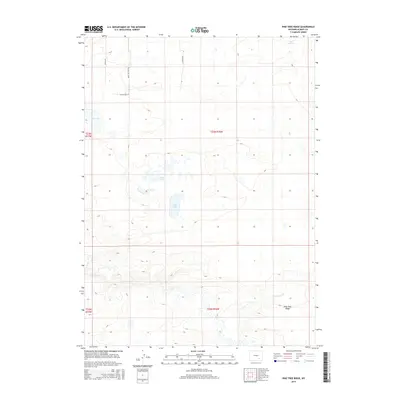
2015 Map of Pine Tree Ridge
USGS Topo · Published 2015About this map
Pine Tree Ridge rises above a distinctive high-desert landscape in Albany County, where a network of seasonal water features and modern residential developments meet. The terrain is defined by the varying elevations surrounding the Sevenmile Cr drainage and the alkaline basins of Soda Lake and Soda Lakes. Further north, Mud Springs and Dry Lake mark the hydrologic character of this arid region. The northwestern corner of the quadrangle shows contemporary land use through a cluster of named roads such as Byerly Dr, Alysheba Dr, and Bold Venture Rd. This configuration of thoroughfares and scattered water sources reflects the modern interface between rural Wyoming ranching traditions and newer residential expansion in the vicinity of the ridge.
Find a feature on this map
14 named features on this map. Tap any name to fly to it.
Don’t see what you’re looking for? This feature index may not catch every label — zoom into the map to look around manually.
Map Details
Editions of this 2015 Pine Tree Ridge Map
This is the sole edition of this map. No revisions or reprints were ever made.
Other maps of this area

1915 · Como Ridge
USGS Topo · 1:48,000

1918 · Como Ridge
USGS Topo · 1:62,500

1954 · Torrington
USGS Topo · 1:250,000

1954 · Cheyenne
USGS Topo · 1:250,000

1954 · Rawlins
USGS Topo · 1:250,000

1955 · Pine Tree Ridge
USGS Topo · 1:24,000

1955 · Sevenmile Spring
USGS Topo · 1:24,000

1955 · Cannonball Cut
USGS Topo · 1:24,000

1955 · Wilcox
USGS Topo · 1:24,000

1955 · Casper
USGS Topo · 1:250,000