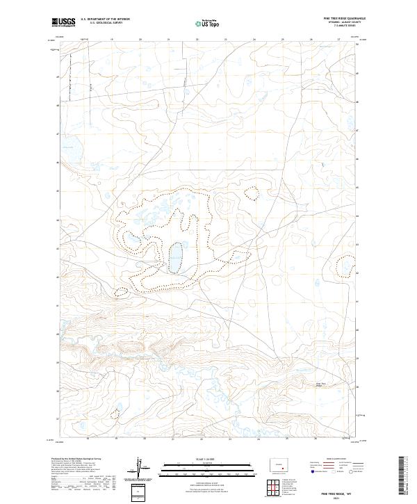
2021 Map of Pine Tree Ridge
USGS Topo · Published 2021About this map
Soda Lake and Dry Lake define the hydrology of this high Albany County landscape, where the seasonal movement of water across an arid basin is clearly visible. The drainage of Rock Creek winds through the southern portion of the quadrangle, passing beneath the namesake Pine Tree Ridge. The terrain is marked by a complex network of public land survey system lines including t23n r76w and t22n r76w, reflecting the historical division of the American West. Isolated water sources such as Mud Springs and the eastern flow of Sevenmile Cr suggest the vital importance of reliable water points in this open country. Modern access is represented by routes like Byerly Dr and Alysheba Dr, which provide paths through the expansive range land.
Find a feature on this map
14 named features on this map. Tap any name to fly to it.
Don’t see what you’re looking for? This feature index may not catch every label — zoom into the map to look around manually.
Map Details
Editions of this 2021 Pine Tree Ridge Map
This is the sole edition of this map. No revisions or reprints were ever made.
Other maps of this area

1915 · Como Ridge
USGS Topo · 1:48,000

1918 · Como Ridge
USGS Topo · 1:62,500

1954 · Torrington
USGS Topo · 1:250,000

1954 · Cheyenne
USGS Topo · 1:250,000

1954 · Rawlins
USGS Topo · 1:250,000

1955 · Pine Tree Ridge
USGS Topo · 1:24,000

1955 · Sevenmile Spring
USGS Topo · 1:24,000

1955 · Cannonball Cut
USGS Topo · 1:24,000

1955 · Wilcox
USGS Topo · 1:24,000

1955 · Casper
USGS Topo · 1:250,000