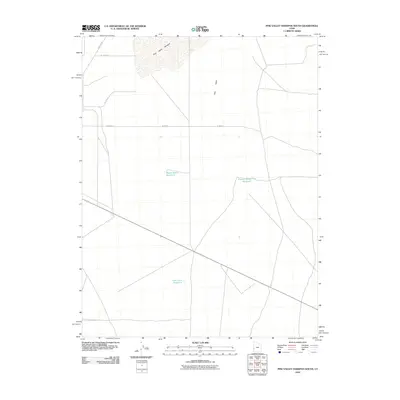
2010 Map of Pine Valley Hardpan South
USGS Topo · Published 2010About this map
Pine Valley Hardpan dominates the northern landscape of this region, representing a distinct geographic feature within the broader Pine Valley. The map reveals a land defined by wide spacing and functional water management, featuring several isolated water bodies including Desert Ranch Reservoir, Electric Fence Reservoir, and Cow Track Reservoir. These sites, along with a rectilinear grid of local roads like W 18400 S and S 25500 W, indicate a landscape organized for ranching or land management in the Great Basin. The sparse distribution of named points suggests a high degree of isolation, where these specific reservoirs served as vital landmarks and resources in a desert environment.
Find a feature on this map
9 named features on this map. Tap any name to fly to it.
Don’t see what you’re looking for? This feature index may not catch every label — zoom into the map to look around manually.
Map Details
Editions of this 2010 Pine Valley Hardpan South Map
This is the sole edition of this map. No revisions or reprints were ever made.
Other maps of this area

1953 · Richfield
USGS Topo · 1:250,000

1958 · Richfield
USGS Topo · 1:250,000

1960 · Wah Wah Summit
USGS Topo · 1:62,500

1971 · Sewing Machine Pass
USGS Topo · 1:24,000

1971 · Halfway Summit
USGS Topo · 1:24,000

1971 · Tunnel Spring
USGS Topo · 1:24,000

1971 · Sawtooth Peak
USGS Topo · 1:24,000

1971 · Lamerdorf Peak NW
USGS Topo · 1:24,000

1980 · Wah Wah Mts. South
USGS Topo · 1:100,000

1980 · Wah Wah Mts. North
USGS Topo · 1:100,000