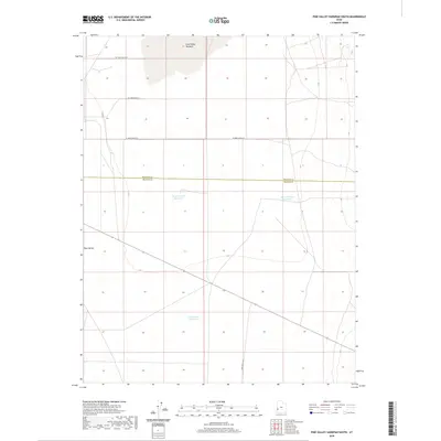
2020 Map of Pine Valley Hardpan South
USGS Topo · Published 2020About this map
Pine Valley's high desert floor is defined by a series of distinct water management features and seasonal catchments situated along the Millard and Beaver County line. The northern portion of this landscape is dominated by the Pine Valley Hardpan, a dry lake bed indicative of the region's interior drainage patterns. Moving south across the valley, a network of named water sources—including Desert Ranch Reservoir, Electric Fence Reservoir, and Cow Track Reservoir—reflects the historic and ongoing importance of stock water for ranching operations in this arid environment. The map details a rectilinear road grid including W 17000 South St and the diagonal track of Pine Valley Rd, providing essential connectivity through the basin's open expanses.
Find a feature on this map
10 named features on this map. Tap any name to fly to it.
Don’t see what you’re looking for? This feature index may not catch every label — zoom into the map to look around manually.
Map Details
Editions of this 2020 Pine Valley Hardpan South Map
This is the sole edition of this map. No revisions or reprints were ever made.
Other maps of this area

1953 · Richfield
USGS Topo · 1:250,000

1958 · Richfield
USGS Topo · 1:250,000

1960 · Wah Wah Summit
USGS Topo · 1:62,500

1971 · Sewing Machine Pass
USGS Topo · 1:24,000

1971 · Halfway Summit
USGS Topo · 1:24,000

1971 · Tunnel Spring
USGS Topo · 1:24,000

1971 · Sawtooth Peak
USGS Topo · 1:24,000

1971 · Lamerdorf Peak NW
USGS Topo · 1:24,000

1980 · Wah Wah Mts. South
USGS Topo · 1:100,000

1980 · Wah Wah Mts. North
USGS Topo · 1:100,000