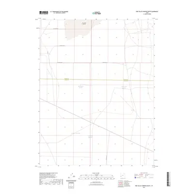
2023 Map of Pine Valley Hardpan South
USGS Topo · Published 2023About this map
Pine Valley defines the arid landscape of this southwestern Utah region, where the broad, flat expanse of the Pine Valley Hardpan dominates the northern terrain. This late-modern survey illustrates a geography shaped by ranching and resource management, spanning the border between Millard and Beaver counties. The distribution of water is central to the area's utility, evidenced by a series of named catchments including Desert Ranch Reservoir, Electric Fence Reservoir, and Cow Track Reservoir. A sparse but deliberate network of corridors such as Pine Valley Rd and a sequence of numbered routes like W 17000 South St provide the necessary access for land management across these vast open flats. The map serves as a precise record of how contemporary infrastructure integrates with the basin's natural drainage patterns.
Find a feature on this map
10 named features on this map. Tap any name to fly to it.
Don’t see what you’re looking for? This feature index may not catch every label — zoom into the map to look around manually.
Map Details
Editions of this 2023 Pine Valley Hardpan South Map
This is the sole edition of this map. No revisions or reprints were ever made.
Other maps of this area

1953 · Richfield
USGS Topo · 1:250,000

1958 · Richfield
USGS Topo · 1:250,000

1960 · Wah Wah Summit
USGS Topo · 1:62,500

1971 · Sewing Machine Pass
USGS Topo · 1:24,000

1971 · Halfway Summit
USGS Topo · 1:24,000

1971 · Tunnel Spring
USGS Topo · 1:24,000

1971 · Sawtooth Peak
USGS Topo · 1:24,000

1971 · Lamerdorf Peak NW
USGS Topo · 1:24,000

1980 · Wah Wah Mts. South
USGS Topo · 1:100,000

1980 · Wah Wah Mts. North
USGS Topo · 1:100,000