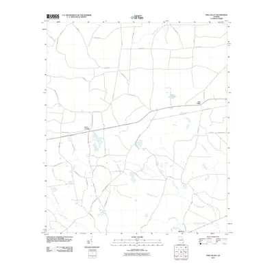
2011 Map of Pine Valley
USGS Topo · Published 2011About this map
Pine Valley and the surrounding rural lowlands of Ware County are defined by a network of drainage systems and a grid of local roads that reflect the area's modern agricultural and residential layout. The landscape is characterized by the slow-moving waters of Big Alligator Creek and Little Alligator Creek in the south, while Stalsby Creek and Tuten Creek wind through the central portions of the quadrangle. Small settlements like Crews Crossing and Glenmore serve as local navigation points along the thoroughfares. This 2011 survey by the U.S. Geological Survey documents the distribution of family-named roads, such as Bud Davis Rd and Billy Jo Hodges Rd, which connect isolated homesites to larger routes like Pine Valley Rd. The presence of distinctive water features like Gator Head Pond highlights the swampy nature of this Georgia coastal plain region.
Find a feature on this map
44 named features on this map. Tap any name to fly to it.
Don’t see what you’re looking for? This feature index may not catch every label — zoom into the map to look around manually.
Map Details
Editions of this 2011 Pine Valley Map
This is the sole edition of this map. No revisions or reprints were ever made.
Other maps of this area

1953 · Waycross
USGS Topo · 1:250,000

1958 · Waycross
USGS Topo · 1:250,000

1967 · Waycross West
USGS Topo · 1:24,000

1967 · Pine Valley
USGS Topo · 1:24,000

1967 · Waycross SW
USGS Topo · 1:24,000

1968 · Homerville East
USGS Topo · 1:24,000

1968 · Manor
USGS Topo · 1:24,000

1968 · Cogdell
USGS Topo · 1:24,000

1971 · Dixie Union
USGS Topo · 1:24,000

1971 · Axson
USGS Topo · 1:24,000