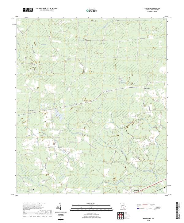
2024 Map of Pine Valley
USGS Topo · Published 2024About this map
Camp Branch Church of God of Prophecy Cem stands in the southwestern corner of this Ware County landscape, a vital point for family historians and genealogists. The terrain is characterized by numerous swampy basins, or "bays," including Footlog Bay, Pittman Bay, Steedley Bay, and Stallard Bay. These features, along with water bodies like Gator Head Pond and Long Pond, suggest a low-lying environment typical of south Georgia’s pine flats.
Find a feature on this map
56 named features on this map. Tap any name to fly to it.
Don’t see what you’re looking for? This feature index may not catch every label — zoom into the map to look around manually.
Map Details
Editions of this 2024 Pine Valley Map
This is the sole edition of this map. No revisions or reprints were ever made.
Other maps of this area

1953 · Waycross
USGS Topo · 1:250,000

1958 · Waycross
USGS Topo · 1:250,000

1967 · Waycross West
USGS Topo · 1:24,000

1967 · Pine Valley
USGS Topo · 1:24,000

1967 · Waycross SW
USGS Topo · 1:24,000

1968 · Homerville East
USGS Topo · 1:24,000

1968 · Manor
USGS Topo · 1:24,000

1968 · Cogdell
USGS Topo · 1:24,000

1971 · Dixie Union
USGS Topo · 1:24,000

1971 · Axson
USGS Topo · 1:24,000