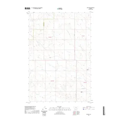
2020 Map of Pine View
USGS Topo · Published 2020About this map
Pine View serves as a small anchor point in this vast drainage network where Yellowstone Co meets Musselshell Co in southern Montana. The landscape is defined by the complex topography of the Bull Mountains, where watercourses like Buffalo Cr and Deadman Cr have carved deep incisions into the terrain. These drainages, including the aptly named Donalds Coulee and Kendall Coulee, dictate the local geography and the path of the few established thoroughfares. Connectivity across this rugged section of the plains is provided by a handful of local routes such as Moore Rd and Custer Pineview Rd, which wind through the township lines of t7n r30e and t6n r31e. The map illustrates a rural area primarily shaped by its hydrology, with Antelope Cr and Hawk Cr marking the headwaters and seasonal flows that characterize the region's agricultural and pastoral potential.
Find a feature on this map
16 named features on this map. Tap any name to fly to it.
Don’t see what you’re looking for? This feature index may not catch every label — zoom into the map to look around manually.
Map Details
Editions of this 2020 Pine View Map
This is the sole edition of this map. No revisions or reprints were ever made.
Other maps of this area

1954 · Forsyth
USGS Topo · 1:250,000

1954 · Roundup
USGS Topo · 1:250,000

1957 · Forsyth
USGS Topo · 1:250,000

1958 · Roundup
USGS Topo · 1:250,000

1958 · Forsyth
USGS Topo · 1:250,000

1979 · Roundup
USGS Topo · 1:100,000

1979 · Corey Flat
USGS Topo · 1:24,000

1979 · Hysham
USGS Topo · 1:100,000

1980 · Mud Butte
USGS Topo · 1:24,000
1980 · P K Ranch NE
USGS Topo · 1:24,000