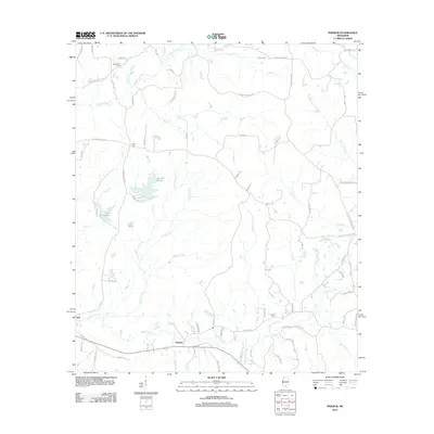
2012 Map of Pinebur
USGS Topo · Published 2012About this map
Pinebur and the neighboring settlement of Hub anchor this corner of Marion County, where the southern Mississippi landscape is defined by an intricate network of waterways and managed reservoirs. The topography is shaped by the drainage basins of Upper Little Cr and Lower Little Cr, which feed into numerous named tributaries such as Beaver Dam Cr and Turkey Br. Significant water bodies like Lake Bill Waller, Lake Columbia, and Lake Waits serve as central landmarks within this timber and agricultural region.
Find a feature on this map
89 named features on this map. Tap any name to fly to it.
Don’t see what you’re looking for? This feature index may not catch every label — zoom into the map to look around manually.
Map Details
Editions of this 2012 Pinebur Map
This is the sole edition of this map. No revisions or reprints were ever made.
Other maps of this area

1953 · Hattiesburg
USGS Topo · 1:250,000

1958 · Hattiesburg
USGS Topo · 1:250,000

1969 · Baxterville SW
USGS Topo · 1:24,000
1969 · Baxterville
USGS Topo · 1:24,000

1969 · Baxterville NE
USGS Topo · 1:24,000

1969 · Pinebur
USGS Topo · 1:24,000

1970 · Columbia South
USGS Topo · 1:24,000

1970 · Columbia North
USGS Topo · 1:24,000
1970 · Sandy Hook
USGS Topo · 1:24,000

1974 · Oloh
USGS Topo · 1:24,000