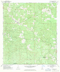
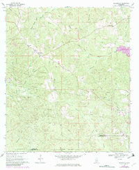
1969 Map of Baxterville
USGS Topo · Published 1971About this map
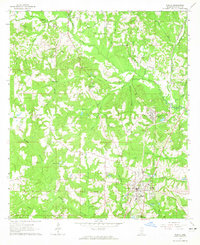
Baxterville Oil and Gas Field dominates the southwestern landscape of this 1969 survey, marked by a dense network of pipelines and service roads. The settlement of Baxterville serves as the local hub, situated near the headwaters of numerous drainages like Clear Creek and Wagon Track Branch. This period in Lamar and Pearl River counties reflects an economy balanced between petroleum extraction and traditional rural life, as evidenced by the Gravel Pits north of town and the scattered religious and social centers. Genealogists can locate family sites through the Baxterville Cem and Myrtle Grove Cem, while the intricate hydrology of the region is defined by features like Burnt Reed Brake and the winding Hobolochitto Creek. The presence of an old Railroad Grade cutting across the central hills suggests a legacy of timber or industrial transport preceding the oil era.
Find a feature on this map
28 named features on this map. Tap any name to fly to it.
Don’t see what you’re looking for? This feature index may not catch every label — zoom into the map to look around manually.
Map Details
Editions of this 1969 Baxterville Map
2 editions found
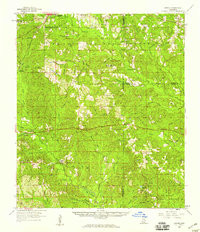
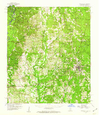
Other maps of this area

1953 · Hattiesburg
USGS Topo · 1:250,000

1953 · Mobile
USGS Topo · 1:250,000

1957 · Mobile
USGS Topo · 1:250,000

1958 · Hattiesburg
USGS Topo · 1:250,000
1958 · Carnes
USGS Topo · 1:62,500
1959 · Poplarville
USGS Topo · 1:62,500

1960 · Mobile
USGS Topo · 1:250,000

1963 · Mobile
USGS Topo · 1:250,000
1964 · Purvis
USGS Topo · 1:24,000
1964 · Lumberton
USGS Topo · 1:24,000