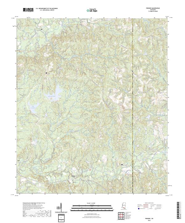
2024 Map of Pinebur
USGS Topo · Published 2024About this map
Pinebur and Hub anchor this rural landscape in Marion and Lamar counties, where the terrain is defined by a dense network of tributaries feeding into the Upper Little Creek and Lower Little Creek systems. The map captures a transition between the elevated Prosper Ridge and the lowland water basins that characterize this part of Mississippi. Significant local landmarks include Lake Bill Waller and Lake Columbia, which dominate the western portion of the quadrangle. For genealogists and local historians, several family-named cemeteries such as Breakfield Cem, Cook Cem, and Pinebur Cem are documented alongside notable small-scale aviation at Beets Airport. The placement of these features relative to historical roads like Columbia Purvis Rd illustrates the long-standing transportation patterns that linked these small timber and farming communities.
Find a feature on this map
90 named features on this map. Tap any name to fly to it.
Don’t see what you’re looking for? This feature index may not catch every label — zoom into the map to look around manually.
Map Details
Editions of this 2024 Pinebur Map
This is the sole edition of this map. No revisions or reprints were ever made.
Other maps of this area

1953 · Hattiesburg
USGS Topo · 1:250,000

1958 · Hattiesburg
USGS Topo · 1:250,000

1969 · Baxterville SW
USGS Topo · 1:24,000
1969 · Baxterville
USGS Topo · 1:24,000

1969 · Baxterville NE
USGS Topo · 1:24,000

1969 · Pinebur
USGS Topo · 1:24,000

1970 · Columbia South
USGS Topo · 1:24,000

1970 · Columbia North
USGS Topo · 1:24,000
1970 · Sandy Hook
USGS Topo · 1:24,000

1974 · Oloh
USGS Topo · 1:24,000