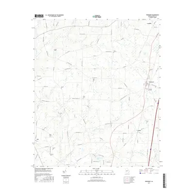
2017 Map of Pinehurst
USGS Topo · Published 2017About this map
Pinehurst and Unadilla anchor the eastern corridor of this Georgia landscape, situated along a primary transportation spine that includes both rail lines and modern highways. The region is defined by a dense network of family and community landmarks, particularly evident in the high concentration of burial grounds such as Evergreen Cem, Mount Olive Cem, and the Pinehurst City Cem. These sites, along with rural religious hubs like Forest Chapel Cem, reflect the deep genealogical roots of Dooly County.
Find a feature on this map
98 named features on this map. Tap any name to fly to it.
Don’t see what you’re looking for? This feature index may not catch every label — zoom into the map to look around manually.
Map Details
Editions of this 2017 Pinehurst Map
This is the sole edition of this map. No revisions or reprints were ever made.
Other maps of this area

1956 · Perry
USGS Topo · 1:62,500

1957 · Macon
USGS Topo · 1:250,000

1958 · Macon
USGS Topo · 1:250,000

1964 · Macon
USGS Topo · 1:250,000

1971 · Pineview NW
USGS Topo · 1:24,000

1971 · Pineview SW
USGS Topo · 1:24,000

1971 · Henderson
USGS Topo · 1:24,000

1971 · Pinehurst
USGS Topo · 1:24,000

1972 · Byromville
USGS Topo · 1:24,000

1972 · Drayton
USGS Topo · 1:24,000