
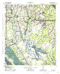
1943 Map of Pineland
USGS Topo · Published 1943About this map
Estill and Pineland anchor this Lowcountry landscape, where the southern boundary of Hampton County meets Jasper County. Published by the Army Map Service during the Second World War, the map illustrates a rural economy built around timber and transport, evidenced by the Highsmith Sawmill and the intersection of the Southern and Seaboard railroads. The map reveals an exceptionally high density of small community hubs, featuring over a dozen local schools such as Newcastle Sch and Titi Sch, alongside numerous churches like Good Hope Ch and Steep Bottom Ch. Much of the terrain is defined by the hydrologic network of the Great Swamp and Cypress Creek, where many settlements are situated on the slightly higher ground of the Sand Hills to avoid the frequent flooding of the surrounding branches.
Find a feature on this map
48 named features on this map. Tap any name to fly to it.
Don’t see what you’re looking for? This feature index may not catch every label — zoom into the map to look around manually.
Map Details
Editions of this 1943 Pineland Map
2 editions found
Other maps of this area

1918 · Varnville
USGS Topo · 1:62,500

1918 · Yemassee
USGS Topo · 1:62,500

1919 · Pineland
USGS Topo · 1:62,500

1919 · Shirley
USGS Topo · 1:62,500

1919 · Cummings
USGS Topo · 1:62,500

1919 · Egypt
USGS Topo · 1:62,500

1920 · Hardeeville
USGS Topo · 1:62,500

1920 · Okatie
USGS Topo · 1:62,500

1920 · Peeples
USGS Topo · 1:62,500

1939 · Egypt
USGS Topo · 1:62,500