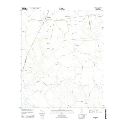
2014 Map of Pinewood
USGS Topo · Published 2014About this map
The town of Pinewood serves as a northern anchor for this landscape where the boundaries of Sumter Co and Clarendon Co meet. The area is defined by a dense network of water bodies and drainages, including the expansive Sammy Swamp and Hungary Hall Branch. Toward the south, the map captures the transition into the marshy fringes of Lake Marion, where Richardson Branch and Jacks Creek flow toward the reservoir. Local genealogy is supported by the locations of Calvary Cem, Richardson Cem, and Brown Cem. The presence of Curtis Millpond and several private ponds like Fox Tindal Pond suggest a history of local water management and land use shaped by the low-lying terrain. Transport centers on routes such as SC-261, linking settlements like Rimini and Panola to the broader region.
Find a feature on this map
96 named features on this map. Tap any name to fly to it.
Don’t see what you’re looking for? This feature index may not catch every label — zoom into the map to look around manually.
Map Details
Editions of this 2014 Pinewood Map
This is the sole edition of this map. No revisions or reprints were ever made.
Other maps of this area

1943 · Eastover
USGS Topo · 1:62,500

1946 · Elloree
USGS Topo · 1:62,500

1946 · Sumter
USGS Topo · 1:62,500

1953 · Poinsett State Park
USGS Topo · 1:24,000

1954 · Augusta
USGS Topo · 1:250,000

1957 · Sumter
USGS Topo · 1:62,500

1957 · Augusta
USGS Topo · 1:250,000

1958 · Augusta
USGS Topo · 1:250,000

1961 · Augusta
USGS Topo · 1:250,000

1962 · Augusta
USGS Topo · 1:250,000