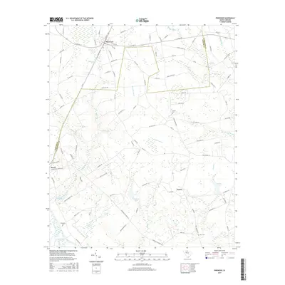
2017 Map of Pinewood
USGS Topo · Published 2017About this map
The town of Pinewood serves as a central hub in this lowland region, where the CSX rail line cuts through a landscape defined by an extensive network of waterways and managed ponds. The terrain is characterized by large swampy basins such as Sammy Swamp and the Great Swamp, feeding into Lake Marion at the southern edge of the survey. The mapping reveals a rural economy historically tied to water management, evidenced by features like Curtis Millpond and Elliott Millpond.
Find a feature on this map
106 named features on this map. Tap any name to fly to it.
Don’t see what you’re looking for? This feature index may not catch every label — zoom into the map to look around manually.
Map Details
Editions of this 2017 Pinewood Map
This is the sole edition of this map. No revisions or reprints were ever made.
Other maps of this area

1943 · Eastover
USGS Topo · 1:62,500

1946 · Elloree
USGS Topo · 1:62,500

1946 · Sumter
USGS Topo · 1:62,500

1953 · Poinsett State Park
USGS Topo · 1:24,000

1954 · Augusta
USGS Topo · 1:250,000

1957 · Sumter
USGS Topo · 1:62,500

1957 · Augusta
USGS Topo · 1:250,000

1958 · Augusta
USGS Topo · 1:250,000

1961 · Augusta
USGS Topo · 1:250,000

1962 · Augusta
USGS Topo · 1:250,000