2024 Map of Pinewood
USGS Topo · Published 2024About this map
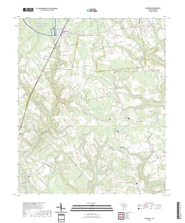
The town of Pinewood sits at the junction of the Sumter Co Clarendon Co boundary, serving as a focal point for this agrarian landscape defined by its swamps and family-named landmarks. The terrain is characterized by intricate drainage systems including Sammy Swamp to the north and the Hungary Hall Branch flowing through the center. This contemporary survey highlights a deep-seated community history, documented through numerous spiritual sites such as New Hope Church and Pisgah Church, each with its associated cemetery. To the northwest, the Poinsett Electronic Combat Range introduces a modern military footprint into the landscape. Between the larger settlements of Rimini and Panola, the map records numerous water features like Gurtis Millpond and G Tindal Pond, which reflect the historical importance of water management for local mills and agriculture in this corner of South Carolina.
Find a feature on this map
112 named features on this map. Tap any name to fly to it.
Don’t see what you’re looking for? This feature index may not catch every label — zoom into the map to look around manually.
Map Details
Editions of this 2024 Pinewood Map
This is the sole edition of this map. No revisions or reprints were ever made.