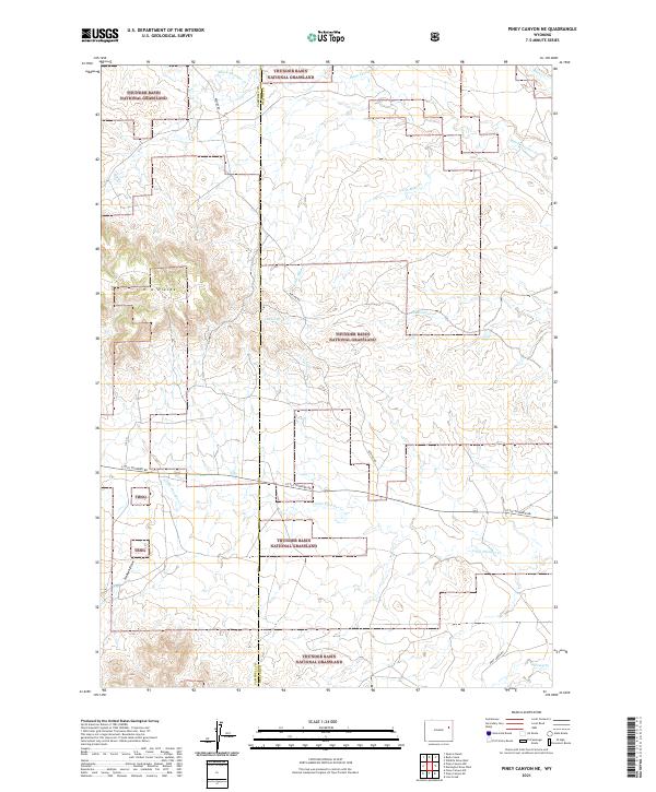
2021 Map of Piney Canyon NE
USGS Topo · Published 2021About this map
Thunder Basin National Grassland dominates this high-plains landscape where the Campbell and Weston County line divides the terrain. The map is defined by a dendritic network of seasonal drainages, notably Black Thunder Cr and Little Thunder Cr, which cut through the open country. Higher ground is marked by the H A Divide, a prominent ridge between the H A Cr and Little Mike Cr watersheds. Settlement is sparse, characterized by long-distance ranch roads and sections of the Public Land Survey System that organize the grassland into large tracts. Local movement across the basin relies on routes like Little Thunder Rd and Keeline Rd, which traverse the undulating topography and cross minor features such as Hansen Draw and Buzzard Cr. This 2021 survey provides a clear look at the contemporary land management boundaries and water-access points within this expansive federal grazing land.
Find a feature on this map
21 named features on this map. Tap any name to fly to it.
Don’t see what you’re looking for? This feature index may not catch every label — zoom into the map to look around manually.
Map Details
Editions of this 2021 Piney Canyon NE Map
This is the sole edition of this map. No revisions or reprints were ever made.
Other maps of this area

1955 · Newcastle
USGS Topo · 1:250,000

1958 · Newcastle
USGS Topo · 1:250,000

1971 · Piney Canyon NE
USGS Topo · 1:24,000

1971 · Open A Ranch
USGS Topo · 1:24,000

1971 · Piney Canyon SW
USGS Topo · 1:24,000

1971 · Piney Canyon NW
USGS Topo · 1:24,000

1971 · Piney Canyon SE
USGS Topo · 1:24,000
1971 · Buck Creek
USGS Topo · 1:24,000

1974 · Reno Junction
USGS Topo · 1:100,000

1979 · Newcastle
USGS Topo · 1:100,000