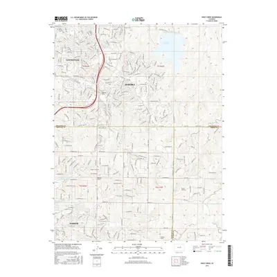
2016 Map of Piney Creek
USGS Topo · Published 2016About this map
Aurora and Centennial dominate the northern half of this landscape, representing the dense residential expansion of the Denver metropolitan area in the early 21st century. The massive Aurora Reservoir serves as a prominent landmark in the northeast, while the suburban grid is carved by natural drainages including Sampson Gulch and Toll Gate Cr. To the south, the town of Parker anchors a transition toward more open terrain where land remains divided by the Public Land Survey System as indicated by the township and range lines of t5s r66w, t5s r65w, t6s r66w, and t6s r65w. This 2016 survey captures the area during a period of significant growth, with new developments pressing against older landmarks like the Everitt Airport and various gulches such as Baldwin Gulch and Sulphur Gulch. The intersection of three counties—Arapahoe, Douglas, and Elbert—meets in the southern portion of the sheet.
Find a feature on this map
94 named features on this map. Tap any name to fly to it.
Don’t see what you’re looking for? This feature index may not catch every label — zoom into the map to look around manually.
Map Details
Editions of this 2016 Piney Creek Map
This is the sole edition of this map. No revisions or reprints were ever made.
Other maps of this area

1890 · East Denver
USGS Topo · 1:125,000

1894 · Castle Rock
USGS Topo · 1:125,000

1913 · Castle Rock
USGS Topo · 1:125,000

1935 · East Denver Nos. 3 and 4
USGS Topo · 1:48,000

1939 · Coal Creek
USGS Topo · 1:24,000

1939 · Elizabeth
USGS Topo · 1:62,500

1940 · Piney Creek
USGS Topo · 1:24,000

1940 · Castle Rock
USGS Topo · 1:62,500

1941 · Fitzsimons
USGS Topo · 1:31,680

1942 · Parker
USGS Topo · 1:31,680