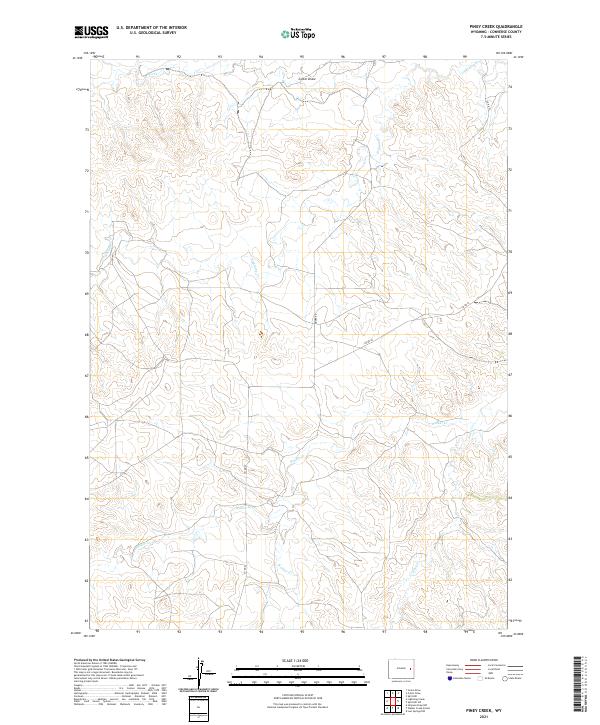
2021 Map of Piney Creek
USGS Topo · Published 2021About this map
Piney Cr and its neighboring drainages define the landscape of this Converse County territory, where the high plains of eastern Wyoming are etched by a series of intermittent watercourses. The map documents a predominantly rural ranching area organized around natural landmarks such as Colter Draw and Box Cr in the north. Transport through these sections is limited to a few secondary thoroughfares, including Moore Rd and Co Rd 43, which navigate the terrain between significant creek beds. The drainage patterns of Lightning Cr, Walker Cr, and Willow Cr suggest a landscape shaped by seasonal hydrology, typical of the regional watershed before these waters eventually join larger river systems outside this quadrangle. This recent survey emphasizes the sparse, open character of the modern western range.
Find a feature on this map
12 named features on this map. Tap any name to fly to it.
Don’t see what you’re looking for? This feature index may not catch every label — zoom into the map to look around manually.
Map Details
Editions of this 2021 Piney Creek Map
This is the sole edition of this map. No revisions or reprints were ever made.
Other maps of this area

1954 · Torrington
USGS Topo · 1:250,000

1955 · Newcastle
USGS Topo · 1:250,000

1958 · Torrington
USGS Topo · 1:250,000

1958 · Newcastle
USGS Topo · 1:250,000

1970 · Bill 4 SE
USGS Topo · 1:24,000

1970 · Walker Creek School
USGS Topo · 1:24,000

1970 · Bill 4 NW
USGS Topo · 1:24,000

1970 · Lost Springs NW
USGS Topo · 1:24,000
1970 · Bill 4 SW
USGS Topo · 1:24,000
1970 · Simpson Draw NW
USGS Topo · 1:24,000