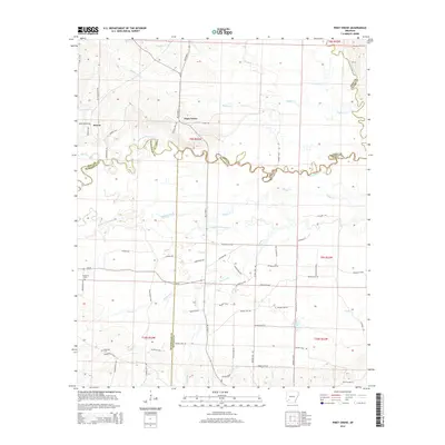
2014 Map of Piney Grove
USGS Topo · Published 2014About this map
The Little Missouri River snakes through the heart of this southwest Arkansas landscape, forming a winding natural boundary between Pike, Hempstead, and Nevada counties. This 2014 survey captures the rural character of the area around Piney Grove and Bowen, where the drainage network is remarkably complex. Waterways like Number One Bayou, Buffalo Creek, and Middle Creek dominate the terrain, illustrating the hydrological significance of the river basin. Genealogists will find the locations of Elizabeth Cem and Ebenezer Cem particularly valuable for local research. The map also documents the extensive network of rural routes, including Ar-29 and Ar 19 HWY S, which connect these dispersed settlements. Near the eastern edge, the Antoine River and Suckles Lake further define the water-rich geography of the region.
Find a feature on this map
72 named features on this map. Tap any name to fly to it.
Don’t see what you’re looking for? This feature index may not catch every label — zoom into the map to look around manually.
Map Details
Editions of this 2014 Piney Grove Map
This is the sole edition of this map. No revisions or reprints were ever made.
Other maps of this area

1901 · Gurdon
USGS Topo · 1:125,000

1906 · Caddo Gap
USGS Topo · 1:125,000

1943 · Antoine
USGS Topo · 1:62,500

1951 · Blevins
USGS Topo · 1:24,000

1951 · Pisgah
USGS Topo · 1:24,000

1953 · El Dorado
USGS Topo · 1:250,000

1955 · Little Rock
USGS Topo · 1:250,000

1956 · Little Rock
USGS Topo · 1:250,000

1957 · El Dorado
USGS Topo · 1:250,000

1958 · El Dorado
USGS Topo · 1:250,000