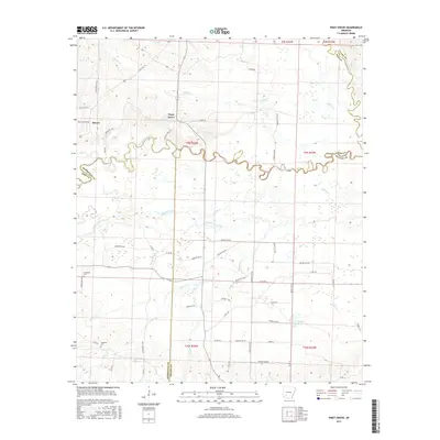
2017 Map of Piney Grove
USGS Topo · Published 2017About this map
Piney Grove sits at the heart of this landscape where the Little Missouri River carves a winding, serpentine path across the Arkansas countryside. The terrain is defined by an intricate network of waterways, from the Antoine River on the eastern border to the smaller channels of Number One Bayou and Middle Creek. This 2017 U.S. Geological Survey representation documents the contemporary road network, including Lewis Lee Rd and Brice Horton Rd, while preserving the locations of historical local landmarks. Genealogists and local historians can find the Elizabeth Cem and Ebenezer Cem, which provide tangible links to the area's ancestral residents. The map also highlights the rural nature of the region, where numerous creeks such as Buffalo Cr and Howard Cr feed into the primary river systems, creating a complex drainage pattern throughout the quadrangle.
Find a feature on this map
64 named features on this map. Tap any name to fly to it.
Don’t see what you’re looking for? This feature index may not catch every label — zoom into the map to look around manually.
Map Details
Editions of this 2017 Piney Grove Map
This is the sole edition of this map. No revisions or reprints were ever made.
Other maps of this area

1901 · Gurdon
USGS Topo · 1:125,000

1906 · Caddo Gap
USGS Topo · 1:125,000

1943 · Antoine
USGS Topo · 1:62,500

1951 · Blevins
USGS Topo · 1:24,000

1951 · Pisgah
USGS Topo · 1:24,000

1953 · El Dorado
USGS Topo · 1:250,000

1955 · Little Rock
USGS Topo · 1:250,000

1956 · Little Rock
USGS Topo · 1:250,000

1957 · El Dorado
USGS Topo · 1:250,000

1958 · El Dorado
USGS Topo · 1:250,000