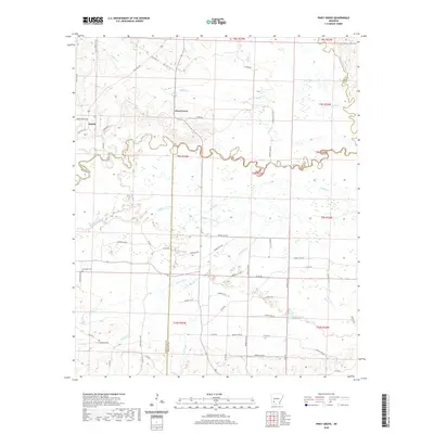
2020 Map of Piney Grove
USGS Topo · Published 2020About this map
The Little Missouri River meanders across this southwest Arkansas landscape, forming the boundary between Pike and Nevada Counties. Near the northern bend of the river, the small settlement of Piney Grove is situated among several agricultural roads, including E Farm Rd and Hendrix Farm Rd. To the west, the community of Bowen sits near the junction of Brice Horton Rd and State Hwy 301, which leads toward the river bottoms.
Find a feature on this map
66 named features on this map. Tap any name to fly to it.
Don’t see what you’re looking for? This feature index may not catch every label — zoom into the map to look around manually.
Map Details
Editions of this 2020 Piney Grove Map
This is the sole edition of this map. No revisions or reprints were ever made.
Other maps of this area

1901 · Gurdon
USGS Topo · 1:125,000

1906 · Caddo Gap
USGS Topo · 1:125,000

1943 · Antoine
USGS Topo · 1:62,500

1951 · Blevins
USGS Topo · 1:24,000

1951 · Pisgah
USGS Topo · 1:24,000

1953 · El Dorado
USGS Topo · 1:250,000

1955 · Little Rock
USGS Topo · 1:250,000

1956 · Little Rock
USGS Topo · 1:250,000

1957 · El Dorado
USGS Topo · 1:250,000

1958 · El Dorado
USGS Topo · 1:250,000