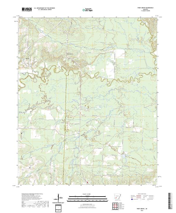
2024 Map of Piney Grove
USGS Topo · Published 2024About this map
The Little Missouri River snakes across this landscape, defining the northern borders of Hempstead and Nevada counties. The terrain is characterized by a dense network of watercourses, including Antoine River, Buffalo Creek, and Number One Bayou, which feed into the river system. Settlement is sparse, anchored by the community of Piney Grove near the center of the quadrangle and Bowen to the northwest. These small rural centers are connected by a grid of county and farm roads, such as E Farm Rd and Hendrix Farm Rd, reflecting the agricultural nature of the region. Local history and genealogy researchers will find significance in the presence of Elizabeth Cem and Ebenezer Cem, which stand as enduring markers of the families who settled this corner of Arkansas. The map also captures the seasonal hydrology of the area, featuring Suckles Lake and various branches like Dry Branch and Flat Branch.
Find a feature on this map
63 named features on this map. Tap any name to fly to it.
Don’t see what you’re looking for? This feature index may not catch every label — zoom into the map to look around manually.
Map Details
Editions of this 2024 Piney Grove Map
This is the sole edition of this map. No revisions or reprints were ever made.
Other maps of this area

1901 · Gurdon
USGS Topo · 1:125,000

1906 · Caddo Gap
USGS Topo · 1:125,000

1943 · Antoine
USGS Topo · 1:62,500

1951 · Blevins
USGS Topo · 1:24,000

1951 · Pisgah
USGS Topo · 1:24,000

1953 · El Dorado
USGS Topo · 1:250,000

1955 · Little Rock
USGS Topo · 1:250,000

1956 · Little Rock
USGS Topo · 1:250,000

1957 · El Dorado
USGS Topo · 1:250,000

1958 · El Dorado
USGS Topo · 1:250,000