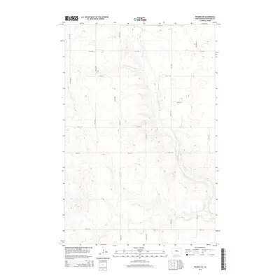
2014 Map of Pingree SW
USGS Topo · Published 2014About this map
Pipestem Creek carves a winding path through the prairie of Stutsman County, shaping the local topography of this section of the Great Plains. The watercourse, also labeled in parts as Pipestem Cr, flows southward toward the expansion of Pipestem Lake in the southeastern corner of the quadrangle. This 2014 survey illustrates a landscape dominated by a methodical grid of rural roads, including 24th St SE and 73rd Ave SE, which partition the undulating terrain into traditional agricultural sections. The map detail highlights the numerous small prairie potholes and depressions characteristic of the region's post-glacial geography, surrounding the primary drainage of the Pipestem valley.
Find a feature on this map
16 named features on this map. Tap any name to fly to it.
Don’t see what you’re looking for? This feature index may not catch every label — zoom into the map to look around manually.
Map Details
Editions of this 2014 Pingree SW Map
This is the sole edition of this map. No revisions or reprints were ever made.
Other maps of this area

1896 · Jamestown
USGS Topo · 1:125,000

1900 · Pingree
USGS Topo · 1:125,000

1900 · Pingree
USGS Topo · 1:62,500

1950 · Buchanan
USGS Topo · 1:24,000

1951 · Pingree
USGS Topo · 1:24,000

1951 · Eldridge NW
USGS Topo · 1:24,000

1952 · Buchanan
USGS Topo · 1:24,000

1952 · Eldridge
USGS Topo · 1:24,000

1952 · Jim Lake
USGS Topo · 1:24,000

1952 · Pingree SW
USGS Topo · 1:24,000