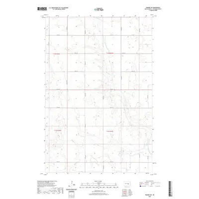
2020 Map of Pingree SW
USGS Topo · Published 2020About this map
Pipestem Creek meanders through this section of Stutsman County, cutting a distinct valley through the prairie landscape. The area is defined by its precise grid of rural section-line roads, such as 71st Ave SE and 21st St SE, which facilitate access to the surrounding agricultural tracts. While the terrain is relatively uniform, the hydrology of Pipestem Cr creates a natural corridor that breaks the geometric regularity of the land survey. Modern infrastructure is represented by Co Hwy 42, which serves as a primary east-west artery through this sparsely populated township region. The map reflects a landscape organized for utility, showing how the drainage of the creek and the township divisions dictate the movement and settlement patterns of central North Dakota.
Find a feature on this map
19 named features on this map. Tap any name to fly to it.
Don’t see what you’re looking for? This feature index may not catch every label — zoom into the map to look around manually.
Map Details
Editions of this 2020 Pingree SW Map
This is the sole edition of this map. No revisions or reprints were ever made.
Other maps of this area

1896 · Jamestown
USGS Topo · 1:125,000

1900 · Pingree
USGS Topo · 1:125,000

1900 · Pingree
USGS Topo · 1:62,500

1950 · Buchanan
USGS Topo · 1:24,000

1951 · Pingree
USGS Topo · 1:24,000

1951 · Eldridge NW
USGS Topo · 1:24,000

1952 · Buchanan
USGS Topo · 1:24,000

1952 · Eldridge
USGS Topo · 1:24,000

1952 · Jim Lake
USGS Topo · 1:24,000

1952 · Pingree SW
USGS Topo · 1:24,000