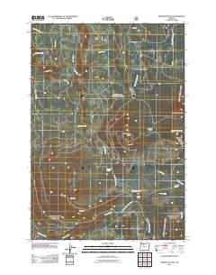
2011 Map of Pinhead Buttes
USGS Topo · Published 2011About this map
The high volcanic terrain of the Cascade Range is defined by a series of prominent peaks and drainage systems including Sisi Butte and the multi-summit Pinhead Buttes. This landscape serves as a critical watershed, where the headwaters of the Clackamas River and the Warm Springs River originate from diverse springs and meadows. The area's history of recreation and forest management is evident in features such as the Warm Springs Cabin and the Lemiti Campground, both situated near the SE Oregon Skyline Rd. The map illustrates a complex network of forest roads and trails that navigate between landmarks like Lemiti Meadow and Trapper Spring Meadow. These open spaces, alongside smaller points like Bear Skull Spring, indicate a wilderness area that has long supported seasonal occupancy and outdoor transit within Clackamas County.
Find a feature on this map
25 named features on this map. Tap any name to fly to it.
Don’t see what you’re looking for? This feature index may not catch every label — zoom into the map to look around manually.
Map Details
Editions of this 2011 Pinhead Buttes Map
This is the sole edition of this map. No revisions or reprints were ever made.
Other maps of this area

1924 · Mount Hood
USGS Topo · 1:125,000

1927 · Mount Hood
USGS Topo · 1:125,000

1927 · Mt. Jefferson
USGS Topo · 1:125,000

1930 · Mt. Jefferson
USGS Topo · 1:125,000

1953 · The Dalles
USGS Topo · 1:250,000

1955 · Bend
USGS Topo · 1:250,000

1956 · The Dalles
USGS Topo · 1:250,000

1956 · High Rock
USGS Topo · 1:62,500

1956 · Mt. Wilson
USGS Topo · 1:62,500

1957 · Bend
USGS Topo · 1:250,000