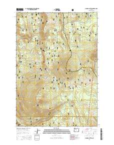
2014 Map of Pinhead Buttes
USGS Topo · Published 2014About this map
Mount Hood National Forest dominates this high-elevation landscape where Clackamas, Marion, and Wasco counties meet. The area is defined by the distinctive volcanic forms of the Pinhead Buttes, including the named north, south, and west summits. This terrain serves as a critical headwaters region, feeding the Clackamas River and the Warm Springs River via numerous mountain creeks like Sisi Cr and Lemiti Cr. High-country meadows such as Trapper Spring Meadow and Lemiti Meadow provide breaks in the dense forest cover. Human passage through this high-relief area is traced by the Pacific Crest National Scenic Trail, which skirts the eastern ridges, and the historic path of the SE Oregon Skyline Rd, reflecting the long-standing importance of these north-south corridors for traverse through the Cascade Range.
Find a feature on this map
29 named features on this map. Tap any name to fly to it.
Don’t see what you’re looking for? This feature index may not catch every label — zoom into the map to look around manually.
Map Details
Editions of this 2014 Pinhead Buttes Map
This is the sole edition of this map. No revisions or reprints were ever made.
Other maps of this area

1924 · Mount Hood
USGS Topo · 1:125,000

1927 · Mount Hood
USGS Topo · 1:125,000

1927 · Mt. Jefferson
USGS Topo · 1:125,000

1930 · Mt. Jefferson
USGS Topo · 1:125,000

1953 · The Dalles
USGS Topo · 1:250,000

1955 · Bend
USGS Topo · 1:250,000

1956 · The Dalles
USGS Topo · 1:250,000

1956 · High Rock
USGS Topo · 1:62,500

1956 · Mt. Wilson
USGS Topo · 1:62,500

1957 · Bend
USGS Topo · 1:250,000