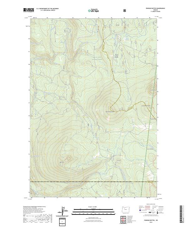
2024 Map of Pinhead Buttes
USGS Topo · Published 2024About this map
Pinhead Buttes rise prominently above the high-elevation terrain where the borders of Clackamas, Wasco, and Marion counties converge. This modern survey illustrates a landscape primarily defined by protected natural corridors, including the expansive Clackamas Wilderness and the Mount Hood National Forest. The presence of the Pacific Crest National Scenic Trl cutting through the eastern portion of the map highlights the area's importance as a passage for long-distance travel through the Cascades. Hydrographic patterns are dominated by the headwaters of the Clackamas River and various high-country wetlands like Warm Springs Meadow and Lemiti Meadow. Small landmarks such as Bear Skull Spring and the distinct summits of West Pinhead Butte and Sisi Butte provide specific orientation points within this densely forested and mountainous terrain.
Find a feature on this map
27 named features on this map. Tap any name to fly to it.
Don’t see what you’re looking for? This feature index may not catch every label — zoom into the map to look around manually.
Map Details
Editions of this 2024 Pinhead Buttes Map
This is the sole edition of this map. No revisions or reprints were ever made.
Other maps of this area

1924 · Mount Hood
USGS Topo · 1:125,000

1927 · Mount Hood
USGS Topo · 1:125,000

1927 · Mt. Jefferson
USGS Topo · 1:125,000

1930 · Mt. Jefferson
USGS Topo · 1:125,000

1953 · The Dalles
USGS Topo · 1:250,000

1955 · Bend
USGS Topo · 1:250,000

1956 · The Dalles
USGS Topo · 1:250,000

1956 · High Rock
USGS Topo · 1:62,500

1956 · Mt. Wilson
USGS Topo · 1:62,500

1957 · Bend
USGS Topo · 1:250,000