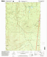
1997 Map of Pinhead Buttes
USGS Topo · Published 1999About this map
Mt Hood National Forest and the Warm Springs Indian Reservation meet along the dramatic ridgelines of the Cascade Range in this late 20th-century survey. The landscape is defined by the volcanic prominence of the Pinhead Buttes, including North Pinhead Butte and South Pinhead Butte, which overlook a complex network of high-altitude water sources. Notable landmarks include the Warm Springs Cabin near Warm Springs Meadow and the Sisi Lookout perched atop Sisi Butte.
Find a feature on this map
32 named features on this map. Tap any name to fly to it.
Don’t see what you’re looking for? This feature index may not catch every label — zoom into the map to look around manually.
Map Details
Editions of this 1997 Pinhead Buttes Map
This is the sole edition of this map. No revisions or reprints were ever made.
Other maps of this area

1924 · Mount Hood
USGS Topo · 1:125,000

1927 · Mount Hood
USGS Topo · 1:125,000

1927 · Mt. Jefferson
USGS Topo · 1:125,000

1930 · Mt. Jefferson
USGS Topo · 1:125,000

1953 · The Dalles
USGS Topo · 1:250,000

1955 · Bend
USGS Topo · 1:250,000

1956 · The Dalles
USGS Topo · 1:250,000

1956 · High Rock
USGS Topo · 1:62,500

1956 · Mt. Wilson
USGS Topo · 1:62,500

1957 · Bend
USGS Topo · 1:250,000