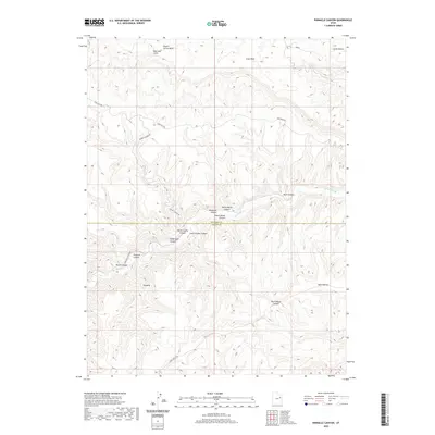
2020 Map of Pinnacle Canyon
USGS Topo · Published 2020About this map
The Duchesne and Carbon County line cuts across a landscape defined by dramatic elevation changes and a dense network of water-carved corridors. The primary drainage of Nine Mile Creek snakes through the lower elevations of Ninemile Canyon, a historical passage through the region's steep geography. To the north, the terrain rises sharply toward the Bad Land Cliffs, while the southern reaches are dominated by the plateau of Horse Bench. This area is characterized by intricate side canyons such as Rock House Canyon, Pinnacle Canyon, and Devils Canyon, each contributing to a complex system of natural drainages. Transportation is limited to narrow routes following these natural paths, including Sand Wash Road and Franks Canyon Road, which provide access to this isolated portion of the Uinta Basin's southern rim.
Find a feature on this map
22 named features on this map. Tap any name to fly to it.
Don’t see what you’re looking for? This feature index may not catch every label — zoom into the map to look around manually.
Map Details
Editions of this 2020 Pinnacle Canyon Map
This is the sole edition of this map. No revisions or reprints were ever made.
Other maps of this area

1885 · East Tavaputs
USGS Topo · 1:250,000

1886 · Price River
USGS Topo · 1:250,000

1896 · Price River
USGS Topo · 1:250,000

1953 · Nutters Hole
USGS Topo · 1:62,500

1953 · Firewater Canyon
USGS Topo · 1:62,500

1954 · Flat Canyon
USGS Topo · 1:62,500

1956 · Price
USGS Topo · 1:250,000

1956 · Grand Junction
USGS Topo · 1:250,000

1959 · Grand Junction
USGS Topo · 1:250,000

1960 · Price
USGS Topo · 1:250,000