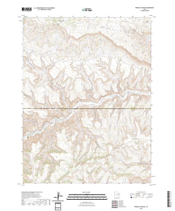
2023 Map of Pinnacle Canyon
USGS Topo · Published 2023About this map
The Duchesne Co and Carbon Co boundary cuts through this high plateau country, dominated by the imposing Bad Land Cliffs and the drainage of Nine Mile Creek. This 2023 survey illustrates the modern transportation network navigating the complex topography, specifically via Nine Mile Canyon Rd and Franks Canyon Rd, which follow the natural contours of the deep Ninemile Canyon. The landscape is defined by its dramatic elevation changes, where named features like Horse Bench sit above a labyrinth of seasonal watercourses including Desert Spring Wash and Sand Wash. The map details the intricate relationship between the canyon floor and the high-altitude landmarks such as Pinnacle Canyon and Rock House Canyon, providing essential data for those studying the contemporary geography of this border region.
Find a feature on this map
19 named features on this map. Tap any name to fly to it.
Don’t see what you’re looking for? This feature index may not catch every label — zoom into the map to look around manually.
Map Details
Editions of this 2023 Pinnacle Canyon Map
This is the sole edition of this map. No revisions or reprints were ever made.
Other maps of this area

1885 · East Tavaputs
USGS Topo · 1:250,000

1886 · Price River
USGS Topo · 1:250,000

1896 · Price River
USGS Topo · 1:250,000

1953 · Nutters Hole
USGS Topo · 1:62,500

1953 · Firewater Canyon
USGS Topo · 1:62,500

1954 · Flat Canyon
USGS Topo · 1:62,500

1956 · Price
USGS Topo · 1:250,000

1956 · Grand Junction
USGS Topo · 1:250,000

1959 · Grand Junction
USGS Topo · 1:250,000

1960 · Price
USGS Topo · 1:250,000