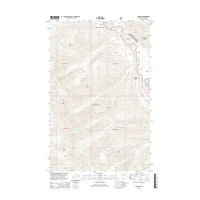
2014 Map of Pinnacle
USGS Topo · Published 2014About this map
The Middle Fork Flathead River carves a critical corridor through the mountainous terrain of the Flathead Range, defining the boundary between Glacier National Park and the Flathead National Forest. This 2014 survey documents the rugged geography near the settlement of Pinnacle, where transportation infrastructure must navigate extreme relief via John F Stevens Canyon. Notable engineered features include Tunnel Number 2 and Tunnel Number 3, which facilitate transit through the narrow pass alongside Us HWY 2. High-altitude water bodies such as Marion Lake, Almeda Lake, and Dickey Lake are scattered across the slopes of Essex Mtn and Mt Liebig. The map also captures the path of Theodore Roosevelt Pass, illustrating the continued importance of this mountain crossing for both modern highway and rail traffic.
Find a feature on this map
65 named features on this map. Tap any name to fly to it.
Don’t see what you’re looking for? This feature index may not catch every label — zoom into the map to look around manually.
Map Details
Editions of this 2014 Pinnacle Map
This is the sole edition of this map. No revisions or reprints were ever made.
Other maps of this area

1914 · Nyack
USGS Topo · 1:125,000

1958 · Nimrod
USGS Topo · 1:24,000

1958 · Felix Peak
USGS Topo · 1:24,000

1960 · Cut Bank
USGS Topo · 1:250,000

1963 · Cut Bank
USGS Topo · 1:250,000

1964 · Cut Bank
USGS Topo · 1:250,000

1964 · Essex
USGS Topo · 1:24,000

1964 · Nyack
USGS Topo · 1:24,000

1964 · Pinnacle
USGS Topo · 1:24,000

1964 · Stanton Lake
USGS Topo · 1:24,000