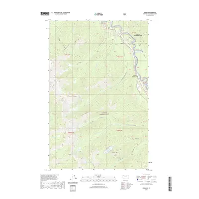
2020 Map of Pinnacle
USGS Topo · Published 2020About this map
The Middle Fork Flathead River carves a deep path through the northern Rockies, forming the natural boundary of Glacier National Park. This corridor, known as John F Stevens Canyon, has long served as a critical passage through the mountains, as evidenced by the engineering of Tunnel Number 1 and Tunnel Number 2 along the rail line. The small settlement of Pinnacle sits at the nexus of several forest roads, including Walker Rd and Lodgepole Ln, providing access to the surrounding Flathead National Forest.
Find a feature on this map
43 named features on this map. Tap any name to fly to it.
Don’t see what you’re looking for? This feature index may not catch every label — zoom into the map to look around manually.
Map Details
Editions of this 2020 Pinnacle Map
This is the sole edition of this map. No revisions or reprints were ever made.
Other maps of this area

1914 · Nyack
USGS Topo · 1:125,000

1958 · Nimrod
USGS Topo · 1:24,000

1958 · Felix Peak
USGS Topo · 1:24,000

1960 · Cut Bank
USGS Topo · 1:250,000

1963 · Cut Bank
USGS Topo · 1:250,000

1964 · Cut Bank
USGS Topo · 1:250,000

1964 · Essex
USGS Topo · 1:24,000

1964 · Nyack
USGS Topo · 1:24,000

1964 · Pinnacle
USGS Topo · 1:24,000

1964 · Stanton Lake
USGS Topo · 1:24,000